The drones taking on a volcano
People who work in IT are geeks. We get excited about the latest smartphones, cameras and tech gadgets but that's not all. Occasionally, however, we are rapt by… volcanoes.
In June El Salvador's Ministry of Environment and Natural Resources (MARN) asked the World Food Programme (WFP) to assess the crater of the highest volcano in the country and the content of its caldera — the rounded hollow that forms after an eruption. Within two weeks WFP's drones team rolled up their sleeves to work on a custom-made solution.
"WFP supports different organizations and government institutions," says WFP El Salvador IT officer, Hugo Rosales. That support is not just emergency response, it can be environmental analysis.
"The idea is to assist these organizations by providing them with immediate information [obtained by drones] to plan and implement a response to any emergency," he says.
Mission to the top
The drone experts catch the bus on a Saturday morning, expecting to see a few sleepy commuters inside. But the seats are filled with colleagues from WFP and partner organizations. There is hardly any space for the drone pilots, so foldable seats are opened up in the aisle and equipment is shoved underneath.
Departing San Salvador, Guns N' Roses' "Welcome to the Jungle" plays on the radio. Lianas, a type of climbing vine, grow thicker as we exit the motorway onto a dirt road.
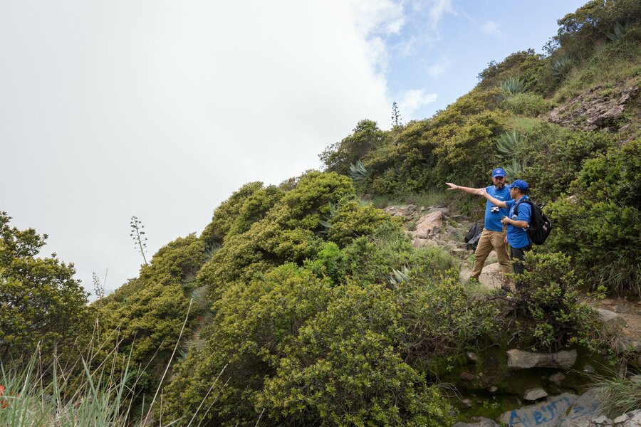
On this day, Santa Ana volcano hides its 2,381-metre peak behind a layer of thick, grey cloud. Like Gandalf in Lord of the Rings, WFP's Hugo Rosales carries a walking stick, guiding us along stoney paths. Giant agave plants appear as we hike and the air fills with an intensifying smell of sulphur. Pink-dotted, green ladybirds and almost-fluorescent grasshoppers are spotted along the path.
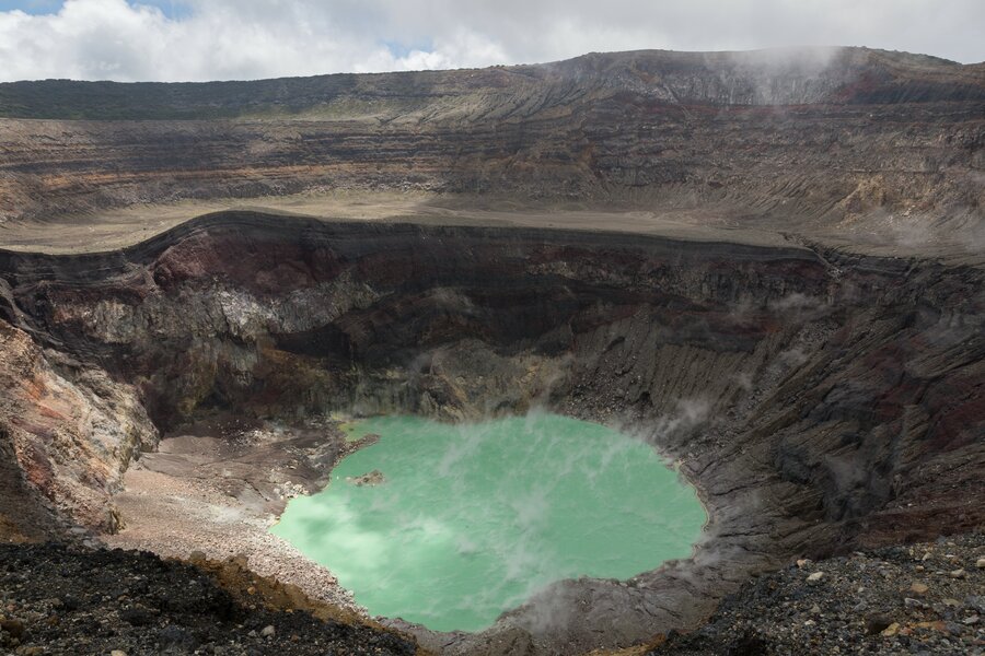
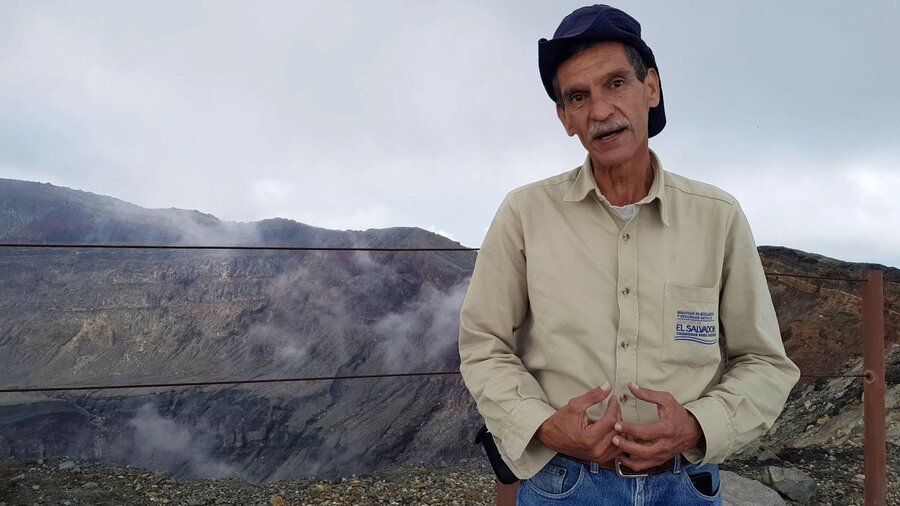
Eduardo Gutiérrez, volcanologist from MARN, explains the geological processes of volcanism once we reach the top. "Each colour represents a different eruption," he says, picking up a few igneous rocks.
Layers of colour form the crater wall — like Rainbow Mountain in Peru — suggesting past lava flows. Santa Ana last erupted in 2005 — for the first time since 1904. The local population were forced to flee. Seismic activity is erratic here and villagers have not been able to return; there is an eeriness to the empty houses that remain at the bottom of the hill.
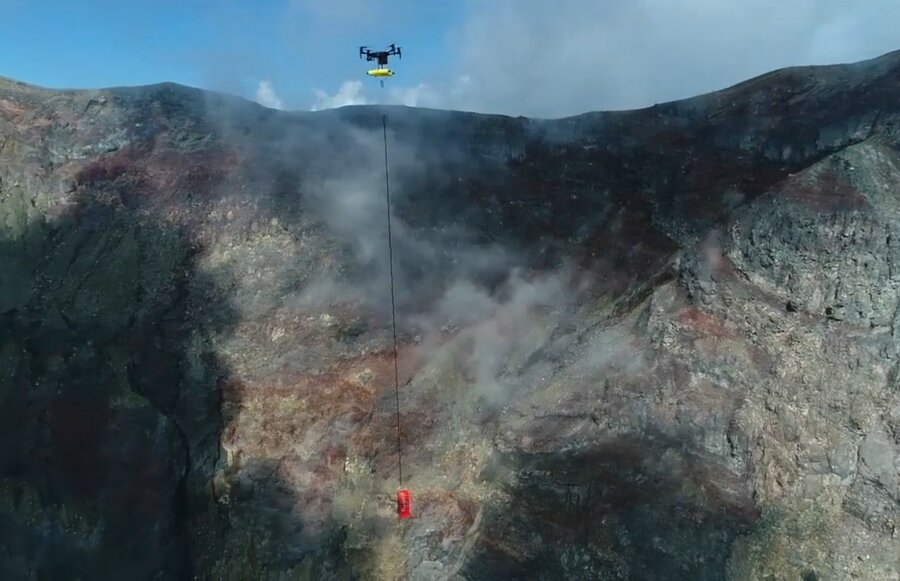
Experienced though MARN is at collecting water samples from volcanoes across El Salvador, Santa Ana's steep hills and toxic fumes are particularly challenging. Until now, water from the caldera could only be captured by firefighters wearing protective gear, lowered on ropes — an expensive and extremely risky procedure last performed over a year ago. Drone pilots can accomplish this same task several times over from a safe distance behind a metal fence.
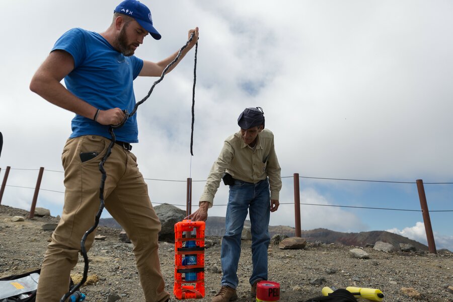
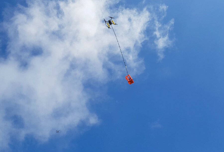
The WFP drones team prepares its equipment. Three mapping drones take off to collect hundreds of images for a 3D model which will facilitate flight planning in the future. Another pilot attaches a canister encased in bright-orange plastic scaffolding to a bigger drone that will do the heavy lifting. The cargo drone takes to the air and disappears into poisonous mist, followed by yet another drone.
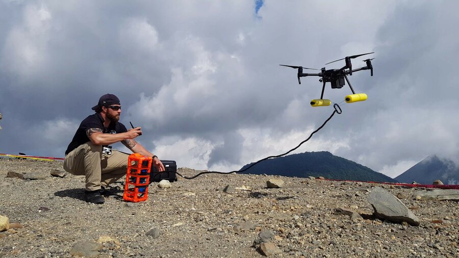
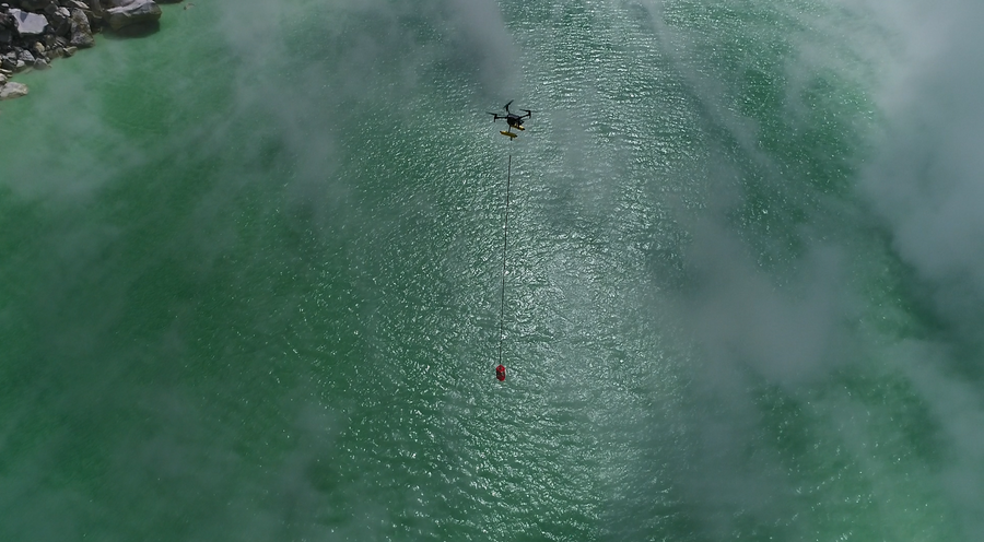
"More to the left. Turn 90 degrees," says Matthew Cua, of WFP partner Help.NGO, as he guides the colleague piloting the cargo drone. The two aircraft jockey for the right position. Matthew shouts: "You are over the water! You can descend now!" Together, the drones descend more than 200 metres into the caldera.
"Water capture confirmed," he says, speaking into his radio to the team on the other side of the crater. Both drones begin their ascent. The rotors of the cargo aircraft are working at maximum capacity.
Did we get the sample on the first attempt? Unfortunately, not, but at least no drones were injured in the process. It takes us another trip the following week and further customization of the container before we eventually manage to capture the type of sample needed for laboratory tests: one litre of highly acidic water.
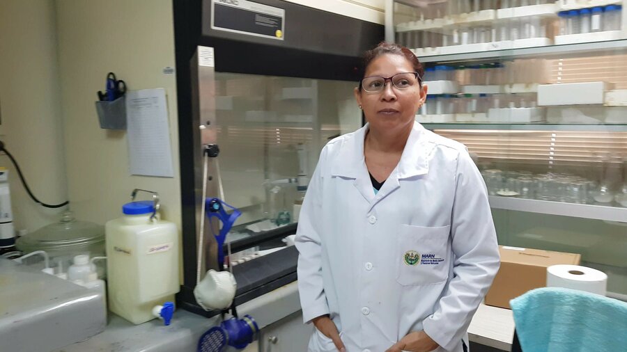
"[Now] we will take it to the lab and analyse its chemical composition," says Gutiérrez. "Such monitoring will happen regularly thanks to the drone programme," he adds.
Observing seismic, thermal and hydrogeochemical indicators, scientists can create a baseline. When there is a deviation in any of the measurements, suggesting an increased volcanic activity, governments will be able to issue a timely warning. "This will help us advance in the early-warning [systems] for the population, so they can get back here," says Gutiérrez. "We will be able to evacuate them when the volcano reactivates, before the damage occurs."
This is just the beginning, according to Adam Marlatt, the mission expert from Help.NGO. He says the next step is to "make this process repeatable while building capacity within the government and WFP to accomplish future missions with local resources."
Both the interest of local actors and the potential of this new technology in the region are apparent. Currently, WFP El Salvador is working closely with MARN to conceptualize the volcano monitoring programme, which will be part of broader emergency preparedness efforts in country, but also in Central America.